
Recruitment


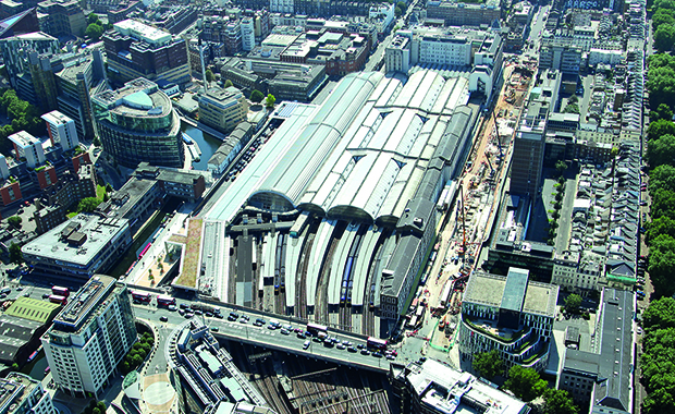
“Picture this: all 20,000 miles of Britain’s rail network mapped out and captured in crisp, high-resolution aerial photography and 3D imagery - all accessed from the safety of the workplace.
This is now a reality thanks to the innovative and tireless work of the Aerial Survey team from Network Rail’s Intelligent Infrastructure programme.
The team has just uploaded data from the final few miles of the Winter Aerial Survey project - providing a complete three-dimensional view of Britain’s entire network - an achievement unmatched across the global rail industry.
Following the success of the first aerial survey in 2014, there were calls for a new and improved survey to be carried out to improve safety and understanding of the network without having to send teams onto track.
Using helicopter-mounted, military-grade, multi-spectrum cameras, the survey was carried out over the last three winters. With reduced vegetation and improved technology it captured the railway with enhanced focus, data and depth.
A complete three-dimensional model of the railway was built using a light detection and ranging (LiDAR) scanner, which bounced a laser off every part of the railway infrastructure, from the track centre-point up to 50 metres either side.
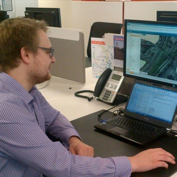
This high spec technology captured an unprecedented quantity of data that had to be processed, cleaned and made useful to the teams on the ground and out on the frontline. The imagery and data was uploaded to NR’s Geo-Rail infrastructure Network Model-Viewer.
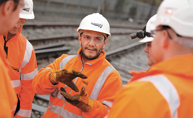
Now complete, it means that teams in the routes can use the data to plan safely and carry out targeted work backed by improved data and a vastly improved view of the railway.
A time-slider comparing digital terrain 3D models from different surveys can show how earthworks have shifted over time and where risks of landslides exist. Aerial data also captured every single tree on the network allowing teams to see where encroachment is occurring to target where and when vegetation management should take place.
It means teams can carry out in-depth planning for major projects - creating a detailed picture of a project site; take measurements; understand topography; order materials precisely; pinpoint access points and carry out risk analysis - all from the safety of the office.
The imagery, data and 3D-modelling presents numerous opportunities for Network Rail to exploit and drive safety, cost savings and efficiencies across the business.
I’ll leave the final word to NRs project manager Johanna Priestley, who said: “3D LiDAR data has given us the ability to plan like never before. We can see every detail of an embankment - even the earth underneath the vegetation to identify slumps or tell-tale signs that a landslip could occur. It means we can plan predictive maintenance and renewal work rather than reactive - it’s a huge breakthrough.”“


“I thought the evening was extremely well organised and the atmosphere was even better than last year, and a far cry from some other awards events held elsewhere. The meal itself was also excellent.”


Latest Twitter Updates
Follow us @RailStaffAwards